
 | |
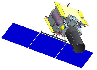
| GSAT - 1, Source: ISRO |
The satellite has been mired in controversy due to the secrecy following the calling off of the launch and also come speculations about what was the reason.
The satellite was to be launched aboard a GSLV – MkIIA (GSLV – F10 mission) with a new 4-meter Ogive shaped payload fairing (OPLF). This would have been the first time the new fairing would have flown aboard a GSLV rocket.
 |
| GSAT - 1 inside the Ogive fairing being mated to the GSLV MkII inside the assembly building, Source: ISRO |
OBJECTIVE
GISAT was a turning point in the Earth observation capability of India since it was the first time an EO satellite would be placed in Geostationary orbit by India. Conventional Earth observation satellites are placed in a near earth orbit which allows the satellite to grasp every minute detail of the earth surface.
However, the downside of these satellites is that they would have only limited sweep time over a fixed area. If we want real-time information, such LEO based satellites are not suitable. Hence, geostationary satellites would have the advantage by surveying a fixed area all the time.
 |
| GSAT - 1 on a test stand, Source: ISRO |
Even though they are advantageous in this regards, there is a huge technological jump from LEO based EO to Geostationary based EO. Geostationary EO satellites require very advanced sensors to keep the temporal resolution of their image high enough to be of any better than the other.
As per ISRO, GISAT – 1 has a very high temporal resolution. It would have the ability to send a selected sector-wise image every 5 minutes and an image of the entire Indian landmass every 30 minutes at 50 m spatial resolution. Even though official sources say the satellite would be used for civilian purposes, such real-time imaging capabilities are of the interest of the military too.
As per official ISRO handout, the objectives are listed as:
- Real time imaging of an area of interest
- Monitoring during natural calamities for effective disaster management
- To obtain spectral signatures for use in other civilian applications like agriculture, forestry, oceanography, etc
PAYLOAD
The satellite is based on the standard I-2K satellite bus platform with minor modifications. It carries hyperspectral and multispectral payloads in different bands with very high temporal and spatial resolution.
The major features of the satellite are:
- 700 mm Ritchey–Chrétien telescope, an optical telescope which works in the visible spectrum to provide real time imaging. It was earlier used for Cartosat – 2A
- Sensor arrays in Short Wave-IR(SWIR) and Visible&Near-IR bands (VNIR)
- High-resolution multi-spectral VNIR (HRMX - VNIR): 50 m resolution
- High-resolution multi-spectral (HRMX - LWIR): 1.5 km resolution
- Hyper-spectral VNIR: 320 m and 192 m resolution
- Hyper-spectral SWIR: 320 m and 192 m resolution
- Electronically steerable phased array
The imaging payloads carried are listed below:
|
SPECTRAL BAND |
RESOLUTION |
|
Multi-Spectral Visible & Near-InfraRed (6 bands) |
42m |
|
Hyper-Spectral Visible & Near-InfraRed (158 bands) |
318m |
|
Hyper-Spectral Short Wave-InfraRed (256 bands) |
191m |
*No launch date is given as of now since the first launch was canceled.
Also Read: GSAT - 02
GSAT – 1 in a glimpse
- Launch mass: 2268 kg
- Launch Vehicle – GSLV MkII (GSLV – F10 mission)
- Orbit altitude: 36,297 km
- Inclination: 19.4 degrees
- Design life: 7 years
- Type/Application: Earth Observation (EO)
- Manufacturer: ISRO


0 Comments